Earth Science

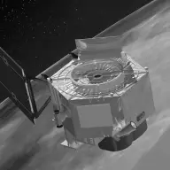
Earth Observing-1 (EO-1)

Orbiter · Competed · Agency-led · Launched on November 21, 2000 · Completed · LCC: $200M/$404M (2025 $)Life-cycle cost: NASA’s reported cost to build, launch, and operate a mission through its prime mission, plus documented partner contributions, in 2025 dollars. Extended missions are not included. Methods · Wikipedia

Scope Active Mission WindowActivePapers published from the first full month after science operations begin through two years after the mission ends. Citations are counted through the third calendar year after each paper appears. For EO-1, papers published December 1, 2000 to April 1, 2019. Methods LifetimeLifetimeEvery tracked publication to date, with every citation to date. For EO-1, papers published from 2001 to November 3, 2026. Methods
Tracked publicationsTracked publications: peer-reviewed papers we found that name the mission or its instruments in their titles, abstracts, or keywords. Papers that used the data without naming it are missed. Methods850
CitationsCitations: every citation these publications have drawn to date. Older missions have had longer to collect them. Methods33,092
Citation indices
h-indexh-index: the largest h such that h papers have at least h citations each. It only grows with time, so older missions score higher. Methods84
g-indexg-index: the largest g for which the g most-cited papers together hold at least g² citations. Like the h-index, but it lets the most-cited papers count for more. Methods147
m-indexm-index: a mission’s h-index divided by the years since its first peer-reviewed paper. It falls every 1 January even when nothing else changes; the figure shown is as of November 3, 2026. It also discounts the long operating life that larger missions paid for. Methods3.2
toritori (total research impact, from SciX): for every paper citing one of the mission’s papers, 1 divided by the citing paper’s reference count times the cited paper’s author count, summed, with self-citations removed. It favors citations from papers with short reference lists and from outside the mission’s own authors. Computed over the tracked citation graph, which can be slightly incomplete. Always over every tracked publication to date, whichever scope is chosen. Methods322
riqriq (research impact quotient): 1,000 times the square root of tori, divided by the years since the mission’s first paper. A rate, not a total, so it does not keep growing with age the way the h-index and tori do. Like tori, always over every tracked publication to date. Methods664

Publications and citations by year (lifetime)

Publications per yearCumulative citations

Institutional contributions (lifetime)The institutions SciX lists for each paper’s authors, as printed on the paper, located through the Research Organization Registry. A square counts a paper once, however many of its authors worked there. Methods

Loading the map…

Tracked publications over the lifetime (850)

All publications CSV · JSON

  1. Summary of current radiometric calibration coefficients for Landsat MSS, TM, ETM+, and EO-1 ALI sensors

    Chander, Gyanesh, 2009, RSEnv

    1,985 lifetime citations

  2. Investigation of the Random Forest Framework for Classification of Hyperspectral Data

    Ham, JiSoo, 2005, ITGRS

    833 lifetime citations

  3. Estimating chlorophyll content from hyperspectral vegetation indices: Modeling and validation

    Wu, Chaoyang, 2008, AgFM

    608 lifetime citations

  4. Comparison of Airborne Hyperspectral Data and EO-1 Hyperion for Mineral Mapping

    Kruse, Fred A., 2003, ITGRS

    523 lifetime citations

  5. Soil organic carbon prediction by hyperspectral remote sensing and field vis-NIR spectroscopy: An Australian case study

    Gomez, Cécile, 2008, Geode

    406 lifetime citations

  6. Calibration and validation of hyperspectral indices for the estimation of broadleaved forest leaf chlorophyll content, leaf mass per area, leaf area index and leaf canopy biomass

    le Maire, Guerric, 2008, RSEnv

    371 lifetime citations

  7. Hyperion, a Space-Based Imaging Spectrometer

    Pearlman, Jay S., 2003, ITGRS

    369 lifetime citations

  8. Satellite Hyperspectral Remote Sensing for Estimating Estuarine and Coastal Water Quality

    Brando, Vittorio E., 2003, ITGRS

    364 lifetime citations

  9. Importance of sample size, data type and prediction method for remote sensing-based estimations of aboveground forest biomass

    Fassnacht, F. E., 2014, RSEnv

    343 lifetime citations

  10. Estimating fractional cover of photosynthetic vegetation, non-photosynthetic vegetation and bare soil in the Australian tropical savanna region upscaling the EO-1 Hyperion and MODIS sensors

    Guerschman, Juan Pablo, 2009, RSEnv

    331 lifetime citations

  11. Preprocessing Eo-1 Hyperion Hyperspectral Data to Support the Application of Agricultural Indexes

    Datt, Bisun, 2003, ITGRS

    325 lifetime citations

  12. Local Manifold Learning-Based k-Nearest-Neighbor for Hyperspectral Image Classification

    Ma, Li, 2010, ITGRS

    319 lifetime citations

  13. Satellite remote sensing of earthquake, volcano, flood, landslide and coastal inundation hazards

    Tralli, David M., 2005, JPRS

    305 lifetime citations

  14. Estimation of Forest Leaf Area Index Using Vegetation Indices Derived From Hyperion Hyperspectral Data

    Gong, Peng, 2003, ITGRS

    297 lifetime citations

  15. Accuracy assessments of hyperspectral waveband performance for vegetation analysis applications

    Thenkabail, Prasad S., 2004, RSEnv

    287 lifetime citations

  16. A Comparison of Land Surface Water Mapping Using the Normalized Difference Water Index from TM, ETM+ and ALI

    Li, Wenbo, 2013, RemS

    284 lifetime citations

  17. Spectral-Spatial Graph Convolutional Networks for Semisupervised Hyperspectral Image Classification

    Qin, Anyong, 2019, IGRSL

    282 lifetime citations

  18. Quantitative detection of chlorophyll in cyanobacterial blooms by satellite remote sensing

    Kutser, Tiit, 2004, LimOc

    274 lifetime citations

  19. Mapping lake CDOM by satellite remote sensing

    Kutser, Tiit, 2005, RSEnv

    252 lifetime citations

  20. A framework for mapping tree species combining hyperspectral and LiDAR data: Role of selected classifiers and sensor across three spatial scales

    Ghosh, Aniruddha, 2014, IJAEO

    247 lifetime citations

How we found these papers

We searched NASA’s Science Explorer (SciX) for peer-reviewed articles naming EO-1 in the title, abstract or keywords; standard filters drop articles that are not peer-reviewed and magazine pieces.

((=abs:"Earth Observing-1" OR =abs:"Earth Observing 1" OR =abs:"Earth Observing One" OR (abs:"EO-1" AND (abs:Hyperion OR =abs:"Advanced Land Imager" OR abs:Landsat OR abs:hyperspectral OR =abs:"remote sensing" OR abs:multispectral OR abs:"ETM+" OR abs:satellite OR =abs:"Earth observation" OR abs:AVIRIS)) OR (abs:Hyperion AND (abs:hyperspectral OR abs:Landsat OR =abs:"remote sensing")) OR =abs:"Advanced Land Imager" OR (abs:"ALI" AND (=abs:"Advanced Land Imager" OR abs:Landsat OR abs:Hyperion)))) AND property:refereed AND doctype:article AND pubdate:[2000-12 TO 2040-01] AND NOT bibstem:("A&R" OR "ACPD" OR "AIASJ" OR "AMTD" OR "AeAm" OR "AirSp" OR "AsNow" OR "AsUAI" OR "AvWST" OR "BGD" OR "C&E" OR "C&T" OR "CAPJ" OR "CliPD" OR "E&S" OR "ENews" OR "ESDD" OR "ESSDD" OR "ESuDD" OR "GID" OR "GMDD" OR "GeCAS" OR "HESSD" OR "IrAJ" OR "JCos" OR "JRASC" OR "LAstr" OR "MNSSA" OR "Met" OR "NHESD" OR "NPGD" OR "NewSc" OR "OcScD" OR "Orion" OR "PhT" OR "PhTea" OR "PhuZ" OR "PhyOJ" OR "PhyW" OR "PlR" OR "SOILD" OR "SciAm" OR "SpFl" OR "TCD" OR "ZemVs")
Open in SciX

Removed after review (3)

  1. Prithvi-EO-2.0: A Versatile Multitemporal Foundation Model for Earth Observation Applications About the Prithvi-EO machine-learning models; not the EO-1 satellite. Decision 🤖
  2. Integrated approach of using ASTER-derived emissivity and pixel temperature for delineating different granitoids ─ a case study in parts of Dharwar Craton, India Uses ASTER data from the Terra satellite, wrongly attributed to EO-1. Decision 🤖
  3. EeteS—The EnMAP End-to-End Simulation Tool Simulation tool for Germany's EnMAP mission; cites EO-1 Hyperion only for comparison. Decision 🤖