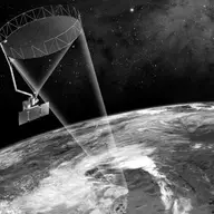
Soil Moisture Active and Passive (SMAP)
Orbiter · Directed · Agency-led · Launched on January 31, 2015 · Extended Mission · LCC: $916M/$1.3B (2025 $) · Wikipedia
| Tracked publications | 1,846 |
|---|---|
| Citations | 41,423 |
| Citation indices | |
|---|---|
| h-index | 93 |
| g-index | 138 |
| m-index | 7.8 |
| tori | 171 |
| riq | 1,005 |
Publications and citations by year (lifetime)
Publications per yearCumulative citations
Institutional contributions (lifetime)
Tracked publications over the lifetime (1,846)
Validation of SMAP surface soil moisture products with core validation sites
589
Assessment of the SMAP Passive Soil Moisture Product
503
The global distribution and dynamics of surface soil moisture
457
Development and assessment of the SMAP enhanced passive soil moisture product
405
-
403
-
283
-
265
Inroads of remote sensing into hydrologic science during the WRR era
262
A 1 km daily soil moisture dataset over China using in situ measurement and machine learning
250
-
239
Global-scale evaluation of SMAP, SMOS and ASCAT soil moisture products using triple collocation
237
Estimation of Soil Moisture from Optical and Thermal Remote Sensing: A Review
233
Soil Moisture Remote Sensing: State-of-the-Science
223
Analysis of CYGNSS Data for Soil Moisture Retrieval
217
-
212
L-band vegetation optical depth and effective scattering albedo estimation from SMAP
210
-
209
SMAP soil moisture improves global evapotranspiration
208
-
206
-
203
How we found these papers
We searched NASA’s Science Explorer (SciX) for peer-reviewed articles naming SMAP in the title, abstract or keywords; standard filters drop articles that are not peer-reviewed and magazine pieces.
((=abs:"Soil Moisture Active Passive" OR =abs:"SMAP Reflectometry" OR (abs:SMAP AND (abs:(satellite OR soil OR radiometer OR microwave OR ocean OR freeze OR thaw OR vegetation OR drought OR SAR) OR =abs:salinity OR =abs:"remote sensing" OR =abs:"land surface" OR =abs:"gap filling" OR abs:"L-band"))) AND NOT =abs:"GIC-SMAP") AND property:refereed AND doctype:article AND pubdate:[2015-04 TO 2040-01] AND NOT bibstem:("A&R" OR "ACPD" OR "AIASJ" OR "AMTD" OR "AeAm" OR "AirSp" OR "AsNow" OR "AsUAI" OR "AvWST" OR "BGD" OR "C&E" OR "C&T" OR "CAPJ" OR "CliPD" OR "E&S" OR "ENews" OR "ESDD" OR "ESSDD" OR "ESuDD" OR "GID" OR "GMDD" OR "GeCAS" OR "HESSD" OR "IrAJ" OR "JCos" OR "JRASC" OR "LAstr" OR "MNSSA" OR "Met" OR "NHESD" OR "NPGD" OR "NewSc" OR "OcScD" OR "Orion" OR "PhT" OR "PhTea" OR "PhuZ" OR "PhyOJ" OR "PhyW" OR "PlR" OR "SOILD" OR "SciAm" OR "SpFl" OR "TCD" OR "ZemVs")
Added after review
- Improved Hydrological Simulation Using SMAP Data: Relative Impacts of Model Calibration and Data Assimilation Assimilates SMAP soil moisture data to improve hydrological simulations.
- Using Smos Passive Microwave Data to Develop Smap Freeze/thaw Algorithms Adapted for the Canadian Subarctic Develops SMAP freeze/thaw algorithms for the Canadian subarctic.
Removed after review
- The Polarimetric L-Band Imaging Synthetic Aperture Radar (PLIS): Description, Calibration, and Cross-Validation Calibrates an airborne radar; mentions SMAP only through its field campaign names.
- Flash flood in the mountainous region of Rio de Janeiro state (Brazil) in 2011: part I—calibration watershed through hydrological SMAP model Uses a hydrological model abbreviated SMAP; not the NASA satellite.
- A SMAP Supervised Classification of Landsat Images for Urban Sprawl Evaluation Uses an image classification method abbreviated SMAP; not the NASA satellite.