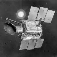
Quick Scatterometer Mission (QuikSCAT)
Orbiter · Directed · Agency-led · Launched on June 20, 1999 · Completed · LCC: $93M/$188M (2025 $) · Wikipedia
| Tracked publications | 826 |
|---|---|
| Citations | 27,116 |
| Citation indices | |
|---|---|
| h-index | 80 |
| g-index | 119 |
| m-index | 3.0 |
| tori | 263 |
| riq | 600 |
Publications and citations by year (lifetime)
Publications per yearCumulative citations
Institutional contributions (lifetime)
Tracked publications over the lifetime (826)
Satellite Measurements Reveal Persistent Small-Scale Features in Ocean Winds
749
-
431
-
425
Annual Cycle of Southeast Asia -- Maritime Continent Rainfall and the Asymmetric Monsoon Transition.
366
Wind as a Long-Distance Dispersal Vehicle in the Southern Hemisphere
350
Rapid reduction of Arctic perennial sea ice
293
-
263
Evaluation of Wind Vectors Observed by QuikSCAT/SeaWinds Using Ocean Buoy Data
247
Forest productivity and water stress in Amazonia: observations from GOSAT chlorophyll fluorescence
247
Image Reconstruction and Enhanced Resolution Imaging from Irregular Samples
208
-
201
-
198
-
197
A QuikSCAT climatology of tropical cyclone size
195
-
194
Modeling distribution of Amazonian tree species and diversity using remote sensing measurements
170
Tip Jets and Barrier Winds: A QuikSCAT Climatology of High Wind Speed Events around Greenland.
167
Interannual variability of the Kuroshio intrusion in the South China Sea
155
Upwelling around Cabo Frio, Brazil: The importance of wind stress curl
153
-
152
How we found these papers
We searched NASA’s Science Explorer (SciX) for peer-reviewed articles naming QuikSCAT in the title, abstract or keywords; standard filters drop articles that are not peer-reviewed and magazine pieces.
((abs:"QuikSCAT" OR abs:QSCAT OR (=abs:"SeaWinds" AND NOT abs:("ADEOS" OR "Midori" OR "Advanced Earth Observing Satellite" OR "Blended SeaWinds")))) AND property:refereed AND doctype:article AND pubdate:[1999-08 TO 2040-01] AND NOT bibstem:("A&R" OR "ACPD" OR "AIASJ" OR "AMTD" OR "AeAm" OR "AirSp" OR "AsNow" OR "AsUAI" OR "AvWST" OR "BGD" OR "C&E" OR "C&T" OR "CAPJ" OR "CliPD" OR "E&S" OR "ENews" OR "ESDD" OR "ESSDD" OR "ESuDD" OR "GID" OR "GMDD" OR "GeCAS" OR "HESSD" OR "IrAJ" OR "JCos" OR "JRASC" OR "LAstr" OR "MNSSA" OR "Met" OR "NHESD" OR "NPGD" OR "NewSc" OR "OcScD" OR "Orion" OR "PhT" OR "PhTea" OR "PhuZ" OR "PhyOJ" OR "PhyW" OR "PlR" OR "SOILD" OR "SciAm" OR "SpFl" OR "TCD" OR "ZemVs")
Added after review
- Adjustment of the summertime marine atmospheric boundary layer to the western Iberia coastal morphology Uses QuikSCAT 2000-2009 wind estimates to study coastal winds off western Iberia.
Removed after review
- On the assimilation of Ku-band scatterometer winds for weather analysis and forecasting Scatterometer wind assimilation study written before QuikSCAT returned data; uses NSCAT and ERS winds.
- Improved resolution backscatter measurements with the SeaWinds pencil-beam scatterometer Signal-processing design for the SeaWinds scatterometer, demonstrated on a synthetic scene; no science result.
- Polarimetric scatterometry: a promising technique for improving ocean surface wind measurements from space Design study for a future polarimetric scatterometer; uses no QuikSCAT data.
- High-Resolution Measurements With a Spaceborne Pencil-Beam Scatterometer Using Combined Range/Doppler Discrimination Techniques Proposes a processing technique for future scatterometers; uses no QuikSCAT data.
- Design and optimization of a Ku-band rotating, range-gated fanbeam scatterometer Design of a different scatterometer; mentions QuikSCAT only as a performance benchmark.
- Russian scatterometer: discussion of the concept and the numerical simulation of wind field retrieval Concept for a Russian scatterometer; mentions SeaWinds only as a design prototype.
- FY-3E Wind Scatterometer Prelaunch and Commissioning Performance Verification Performance tests of China's FY-3E scatterometer; names SeaWinds only in a list.
- QGIS Shoreline Change Analysis Tool (QSCAT): A fast, open-source shoreline change analysis plugin for QGIS Describes a shoreline-analysis software tool also called QSCAT; not the QuikSCAT mission.
- Acceleration and spatial reorganization of bank erosion under prolonged sediment starvation: multi-decadal evidence from the Vam Nao channel River-bank erosion study; QSCAT here is a shoreline-analysis software tool.
- Research on the Parameter Design Method and System Simulation of Multimode Microwave Remote Sensors Operating in Scatterometer Modes Design method for a new radar sensor; mentions QuikSCAT only as a performance benchmark.