Earth Science

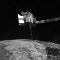
Ice, Cloud, and Land Elevation Satellite 2 (ICESat-2)

Orbiter · Directed · Agency-led · Launched on September 15, 2018 · Extended Mission · LCC: $1.1B/$1.5B (2025 $)Life-cycle cost: NASA’s reported cost to build, launch, and operate a mission through its prime mission, plus documented partner contributions, in 2025 dollars. Extended missions are not included. Methods · Wikipedia

Scope Active Mission WindowActivePapers published from the first full month after science operations begin through two years after the mission ends. Citations are counted through the third calendar year after each paper appears. For ICESat-2, papers published October 1, 2018 to January 1, 2024. Methods LifetimeLifetimeEvery tracked publication to date, with every citation to date. For ICESat-2, papers published from 2018 to November 3, 2026. Methods
Tracked publicationsTracked publications: peer-reviewed papers we found that name the mission or its instruments in their titles, abstracts, or keywords. Papers that used the data without naming it are missed. Methods1,279
CitationsCitations: every citation these publications have drawn to date. Older missions have had longer to collect them. Methods19,878
Citation indices
h-indexh-index: the largest h such that h papers have at least h citations each. It only grows with time, so older missions score higher. Methods62
g-indexg-index: the largest g for which the g most-cited papers together hold at least g² citations. Like the h-index, but it lets the most-cited papers count for more. Methods101
m-indexm-index: a mission’s h-index divided by the years since its first peer-reviewed paper. It falls every 1 January even when nothing else changes; the figure shown is as of November 3, 2026. It also discounts the long operating life that larger missions paid for. Methods6.9
toritori (total research impact, from SciX): for every paper citing one of the mission’s papers, 1 divided by the citing paper’s reference count times the cited paper’s author count, summed, with self-citations removed. It favors citations from papers with short reference lists and from outside the mission’s own authors. Computed over the tracked citation graph, which can be slightly incomplete. Always over every tracked publication to date, whichever scope is chosen. Methods82
riqriq (research impact quotient): 1,000 times the square root of tori, divided by the years since the mission’s first paper. A rate, not a total, so it does not keep growing with age the way the h-index and tori do. Like tori, always over every tracked publication to date. Methods904

Publications and citations by year (lifetime)

Publications per yearCumulative citations

Institutional contributions (lifetime)The institutions SciX lists for each paper’s authors, as printed on the paper, located through the Research Organization Registry. A square counts a paper once, however many of its authors worked there. Methods

Loading the map…

Tracked publications over the lifetime (1,279)

All publications CSV · JSON

  1. The Ice, Cloud, and Land Elevation Satellite - 2 mission: A global geolocated photon product derived from the Advanced Topographic Laser Altimeter System

    Neumann, Thomas A., 2019, RSEnv

    477 lifetime citations

  2. Pervasive ice sheet mass loss reflects competing ocean and atmosphere processes

    Smith, Ben, 2020, Sci

    419 lifetime citations

  3. The ATL08 land and vegetation product for the ICESat-2 Mission

    Neuenschwander, Amy, 2019, RSEnv

    405 lifetime citations

  4. Human alteration of global surface water storage variability

    Cooley, Sarah W., 2021, Natur

    393 lifetime citations

  5. Validation of ICESat-2 ATLAS Bathymetry and Analysis of ATLAS's Bathymetric Mapping Performance

    Parrish, Christopher E., 2019, RemS

    337 lifetime citations

  6. Satellite-derived bathymetry using the ICESat-2 lidar and Sentinel-2 imagery datasets

    Ma, Yue, 2020, RSEnv

    277 lifetime citations

  7. Performance evaluation of GEDI and ICESat-2 laser altimeter data for terrain and canopy height retrievals

    Liu, Aobo, 2021, RSEnv

    272 lifetime citations

  8. Biomass estimation from simulated GEDI, ICESat-2 and NISAR across environmental gradients in Sonoma County, California

    Duncanson, Laura, 2020, RSEnv

    195 lifetime citations

  9. High-resolution mapping of forest canopy height using machine learning by coupling ICESat-2 LiDAR with Sentinel-1, Sentinel-2 and Landsat-8 data

    Li, Wang, 2020, IJAEO

    189 lifetime citations

  10. Tibetan Plateau's Lake Level and Volume Changes From NASA's ICESat/ICESat-2 and Landsat Missions

    Zhang, Guoqing, 2019, GeoRL

    180 lifetime citations

  11. Canopy and Terrain Height Retrievals with ICESat-2: A First Look

    Neuenschwander, Amy L., 2019, RemS

    178 lifetime citations

  12. Neural network guided interpolation for mapping canopy height of China's forests by integrating GEDI and ICESat-2 data

    Liu, Xiaoqiang, 2022, RSEnv

    174 lifetime citations

  13. Validation of ICESat-2 terrain and canopy heights in boreal forests

    Neuenschwander, Amy, 2020, RSEnv

    168 lifetime citations

  14. Fusing simulated GEDI, ICESat-2 and NISAR data for regional aboveground biomass mapping

    Silva, Carlos Alberto, 2021, RSEnv

    168 lifetime citations

  15. Land ice height-retrieval algorithm for NASA's ICESat-2 photon-counting laser altimeter

    Smith, Benjamin, 2019, RSEnv

    160 lifetime citations

  16. Assessment of ICESat-2 Ice Sheet Surface Heights, Based on Comparisons Over the Interior of the Antarctic Ice Sheet

    Brunt, K. M., 2019, GeoRL

    145 lifetime citations

  17. Mapping Forest Height and Aboveground Biomass by Integrating ICESat-2, Sentinel-1 and Sentinel-2 Data Using Random Forest Algorithm in Northwest Himalayan Foothills of India

    Nandy, Subrata, 2021, GeoRL

    142 lifetime citations

  18. A semi-empirical scheme for bathymetric mapping in shallow water by ICESat-2 and Sentinel-2: A case study in the South China Sea

    Hsu, Hsiao-Jou, 2021, JPRS

    134 lifetime citations

  19. Land cover classification in an era of big and open data: Optimizing localized implementation and training data selection to improve mapping outcomes

    Hermosilla, Txomin, 2022, RSEnv

    134 lifetime citations

  20. Estimating aboveground biomass and forest canopy cover with simulated ICESat-2 data

    Narine, Lana L., 2019, RSEnv

    130 lifetime citations

How we found these papers

We searched NASA’s Science Explorer (SciX) for peer-reviewed articles naming ICESat-2 in the title, abstract or keywords; standard filters drop articles that are not peer-reviewed and magazine pieces.

((=abs:"ICESat-2" OR abs:"ICESat 2" OR abs:"Ice, Cloud, and Land Elevation Satellite 2" OR =abs:"Advanced Topographic Laser Altimeter System")) AND property:refereed AND doctype:article AND pubdate:[2018-10 TO 2040-01] AND NOT bibstem:("A&R" OR "ACPD" OR "AIASJ" OR "AMTD" OR "AeAm" OR "AirSp" OR "AsNow" OR "AsUAI" OR "AvWST" OR "BGD" OR "C&E" OR "C&T" OR "CAPJ" OR "CliPD" OR "E&S" OR "ENews" OR "ESDD" OR "ESSDD" OR "ESuDD" OR "GID" OR "GMDD" OR "GeCAS" OR "HESSD" OR "IrAJ" OR "JCos" OR "JRASC" OR "LAstr" OR "MNSSA" OR "Met" OR "NHESD" OR "NPGD" OR "NewSc" OR "OcScD" OR "Orion" OR "PhT" OR "PhTea" OR "PhuZ" OR "PhyOJ" OR "PhyW" OR "PlR" OR "SOILD" OR "SciAm" OR "SpFl" OR "TCD" OR "ZemVs")

Open in SciX

Removed after review (2)

  1. Research and Industry News Industry news digest that lists ICESat-2 among unrelated items; not a research paper. Decision 🤖
  2. Assessing Novel Lidar Modalities for Maximizing Coverage of a Spaceborne System through the Use of Diode Lasers Concept study of diode-laser designs for future lidar missions; ICESat-2 is only a comparator. Decision 🤖