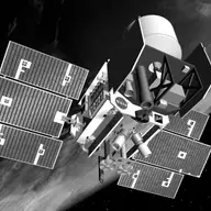
Orbiter · Directed · Agency-led · Launched on January 13, 2003 · Completed · LCC: $200M/$375M (2025 $)Life-cycle cost: NASA’s reported cost to build, launch, and operate a mission through its prime mission, plus documented partner contributions, in 2025 dollars. Extended missions are not included. Methods · Wikipedia
ScopeActive Mission WindowActivePapers published from the first full month after science operations begin through two years after the mission ends. Citations are counted through the third calendar year after each paper appears. For ICESat, papers published February 1, 2003 to September 1, 2012. Methods/LifetimeLifetimeEvery tracked publication to date, with every citation to date. For ICESat, papers published from 2003 to November 3, 2026. Methods
Tracked publicationsTracked publications: peer-reviewed papers we found that name the mission or its instruments in their titles, abstracts, or keywords. Papers that used the data without naming it are missed. Methods
782
CitationsCitations: every citation these publications have drawn to date. Older missions have had longer to collect them. Methods
39,074
Citation indices
h-indexh-index: the largest h such that h papers have at least h citations each. It only grows with time, so older missions score higher. Methods
95
g-indexg-index: the largest g for which the g most-cited papers together hold at least g² citations. Like the h-index, but it lets the most-cited papers count for more. Methods
166
m-indexm-index: a mission’s h-index divided by the years since its first peer-reviewed paper. It falls every 1 January even when nothing else changes; the figure shown is as of November 3, 2026. It also discounts the long operating life that larger missions paid for. Methods
4.0
toritori (total research impact, from SciX): for every paper citing one of the mission’s papers, 1 divided by the citing paper’s reference count times the cited paper’s author count, summed, with self-citations removed. It favors citations from papers with short reference lists and from outside the mission’s own authors. Computed over the tracked citation graph, which can be slightly incomplete. Always over every tracked publication to date, whichever scope is chosen. Methods
251
riqriq (research impact quotient): 1,000 times the square root of tori, divided by the years since the mission’s first paper. A rate, not a total, so it does not keep growing with age the way the h-index and tori do. Like tori, always over every tracked publication to date. Methods
660
Publications and citations by year (lifetime)
Publications per yearCumulative citations
Institutional contributions (lifetime)The institutions SciX lists for each paper’s authors, as printed on the paper, located through the Research Organization Registry. A square counts a paper once, however many of its authors worked there. Methods
We searched NASA’s Science Explorer (SciX) for peer-reviewed articles naming ICESat in the title, abstract or keywords; standard filters drop articles that are not peer-reviewed and magazine pieces.
((((abs:"ICESat" OR abs:"ICESat-1" OR abs:"GLAS" OR =abs:"Geoscience Laser Altimeter System") AND (abs:"satellite" OR abs:"remote sensing" OR abs:"laser altimetry" OR abs:"laser altimeter")) OR abs:"Ice, Clouds and Land Elevation Satellite" OR abs:"Geoscience Laser Altimeter System") AND NOT (abs:"ICESat-2" AND NOT (abs:"ICESat-1" OR abs:"GLAS" OR =abs:"Geoscience Laser Altimeter System" OR =abs:"ICESat ICESat-2" OR =abs:"ICESat 2003" OR =abs:"ICESat data" OR =abs:"ICESat mission" OR =abs:"ICESat CryoSat" OR =abs:"ICESat Ice Cloud"))) AND property:refereed AND doctype:article AND pubdate:[2003-02 TO 2040-01] AND NOT bibstem:("A&R" OR "ACPD" OR "AIASJ" OR "AMTD" OR "AeAm" OR "AirSp" OR "AsNow" OR "AsUAI" OR "AvWST" OR "BGD" OR "C&E" OR "C&T" OR "CAPJ" OR "CliPD" OR "E&S" OR "ENews" OR "ESDD" OR "ESSDD" OR "ESuDD" OR "GID" OR "GMDD" OR "GeCAS" OR "HESSD" OR "IrAJ" OR "JCos" OR "JRASC" OR "LAstr" OR "MNSSA" OR "Met" OR "NHESD" OR "NPGD" OR "NewSc" OR "OcScD" OR "Orion" OR "PhT" OR "PhTea" OR "PhuZ" OR "PhyOJ" OR "PhyW" OR "PlR" OR "SOILD" OR "SciAm" OR "SpFl" OR "TCD" OR "ZemVs")