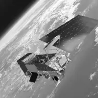
Earth Science

Aqua

Orbiter · Directed · Agency-led · Launched on May 4, 2002 · Extended Mission · LCC: $1.1B/$2.3B (2025 $)Life-cycle cost: NASA’s reported cost to build, launch, and operate a mission through its prime mission, plus documented partner contributions, in 2025 dollars. Extended missions are not included. Methods · Wikipedia

Scope Active Mission WindowActivePapers published from the first full month after science operations begin through two years after the mission ends. Citations are counted through the third calendar year after each paper appears. For Aqua, papers published June 1, 2002 to January 1, 2024. Methods LifetimeLifetimeEvery tracked publication to date, with every citation to date. For Aqua, papers published from 2002 to November 3, 2026. Methods
Tracked publicationsTracked publications: peer-reviewed papers we found that name the mission or its instruments in their titles, abstracts, or keywords. Papers that used the data without naming it are missed. Methods12,182
CitationsCitations: every citation these publications have drawn to date. Older missions have had longer to collect them. Methods452,573
Citation indices
h-indexh-index: the largest h such that h papers have at least h citations each. It only grows with time, so older missions score higher. Methods225
g-indexg-index: the largest g for which the g most-cited papers together hold at least g² citations. Like the h-index, but it lets the most-cited papers count for more. Methods375
m-indexm-index: a mission’s h-index divided by the years since its first peer-reviewed paper. It falls every 1 January even when nothing else changes; the figure shown is as of November 3, 2026. It also discounts the long operating life that larger missions paid for. Methods9.0
toritori (total research impact, from SciX): for every paper citing one of the mission’s papers, 1 divided by the citing paper’s reference count times the cited paper’s author count, summed, with self-citations removed. It favors citations from papers with short reference lists and from outside the mission’s own authors. Computed over the tracked citation graph, which can be slightly incomplete. Always over every tracked publication to date, whichever scope is chosen. Methods2,820
riqriq (research impact quotient): 1,000 times the square root of tori, divided by the years since the mission’s first paper. A rate, not a total, so it does not keep growing with age the way the h-index and tori do. Like tori, always over every tracked publication to date. Methods2,042

Publications and citations by year (lifetime)

Publications per yearCumulative citations

Institutional contributions (lifetime)The institutions SciX lists for each paper’s authors, as printed on the paper, located through the Research Organization Registry. A square counts a paper once, however many of its authors worked there. Methods

Loading the map…

Tracked publications over the lifetime (12,182)

All publications CSV · JSON

  1. The MODIS Aerosol Algorithm, Products, and Validation.

    Remer, L. A., 2005, JAtS

    2,350 lifetime citations

  2. Global fire emissions and the contribution of deforestation, savanna, forest, agricultural, and peat fires (1997-2009)

    van der Werf, G. R., 2010, ACP

    2,110 lifetime citations

  3. Monitoring vegetation phenology using MODIS

    Zhang, Xiaoyang, 2003, RSEnv

    1,947 lifetime citations

  4. A simple method for reconstructing a high-quality NDVI time-series data set based on the Savitzky-Golay filter

    Chen, Jin, 2004, RSEnv

    1,765 lifetime citations

  5. The Collection 6 MODIS aerosol products over land and ocean

    Levy, R. C., 2013, AMT

    1,626 lifetime citations

  6. Development of a two-band enhanced vegetation index without a blue band

    Jiang, Zhangyan, 2008, RSEnv

    1,561 lifetime citations

  7. Change detection techniques

    Lu, D., 2004, IJRS

    1,549 lifetime citations

  8. On the Blending of the Landsat and MODIS Surface Reflectance: Predicting Daily Landsat Surface Reflectance

    Gao, Feng, 2006, ITGRS

    1,493 lifetime citations

  9. The MODIS Cloud Products: Algorithms and Examples From Terra

    Platnick, Steven, 2003, ITGRS

    1,437 lifetime citations

  10. A Continuous Satellite-Derived Measure of Global Terrestrial Primary Production

    Running, Steven W., 2004, BiSci

    1,399 lifetime citations

  11. Detecting trend and seasonal changes in satellite image time series

    Verbesselt, Jan, 2010, RSEnv

    1,339 lifetime citations

  12. Preliminary analysis of the performance of the Landsat 8/OLI land surface reflectance product

    Vermote, Eric, 2016, RSEnv

    1,312 lifetime citations

  13. A Landsat Surface Reflectance Dataset for North America, 1990─2000

    Masek, Jeffrey G., 2006, IGRSL

    1,308 lifetime citations

  14. An Enhanced Contextual Fire Detection Algorithm for MODIS

    Giglio, Louis, 2003, RSEnv

    1,250 lifetime citations

  15. Soil Moisture Retrieval From AMSR-E

    Njoku, Eni G., 2003, ITGRS

    1,152 lifetime citations

  16. The collection 6 MODIS active fire detection algorithm and fire products

    Giglio, Louis, 2016, RSEnv

    1,149 lifetime citations

  17. Finer resolution observation and monitoring of global land cover: first mapping results with Landsat TM and ETM+ data

    Gong, Peng, 2013, IJRS

    1,101 lifetime citations

  18. Biomass burning emissions estimated with a global fire assimilation system based on observed fire radiative power

    Kaiser, J. W., 2012, BGeo

    1,098 lifetime citations

  19. Sensitivity of global terrestrial ecosystems to climate variability

    Seddon, Alistair W. R., 2016, Natur

    1,098 lifetime citations

  20. AIRS/AMSU/HSB on the Aqua Mission: Design, Science Objectives, Data Products, and Processing Systems

    Aumann, Hartmut H., 2003, ITGRS

    1,097 lifetime citations

How we found these papers

We searched NASA’s Science Explorer (SciX) for peer-reviewed articles naming Aqua in the title, abstract or keywords; standard filters drop articles that are not peer-reviewed and magazine pieces.

(((abs:"Aqua" AND (=abs:"AIRS" OR =abs:"AMSU" OR =abs:"CERES" OR =abs:"MODIS" OR =abs:"AMSR-E" OR =abs:"HSB")) OR =abs:"Advanced Microwave Scanning Radiometer-EOS" OR (=abs:"Moderate Resolution Imaging Spectroradiometer" AND abs:"Aqua") OR (=abs:"Moderate Resolution Imaging Spectroradiometer" AND NOT abs:"Terra") OR (=abs:"Advanced Microwave Sounding Unit" AND (abs:(Aqua OR AIRS OR "AMSR-E") OR =abs:"Advanced Microwave Scanning Radiometer for the Earth Observing System")) OR =abs:"Humidity Sounder for Brazil" OR =abs:"Atmospheric Infrared Sounder" OR (=abs:"Clouds and the Earth's Radiant Energy System" AND abs:"Aqua") OR (=abs:"Clouds and the Earth's Radiant Energy System" AND NOT abs:"Terra") OR abs:"Aqua satellite" OR abs:"Aqua spacecraft" OR abs:"Aqua Earth-Observing" OR abs:"EOS-PM1" OR abs:"EOS PM-1")) AND property:refereed AND doctype:article AND pubdate:[2002-06 TO 2040-01] AND NOT bibstem:("A&R" OR "ACPD" OR "AIASJ" OR "AMTD" OR "AeAm" OR "AirSp" OR "AsNow" OR "AsUAI" OR "AvWST" OR "BGD" OR "C&E" OR "C&T" OR "CAPJ" OR "CliPD" OR "E&S" OR "ENews" OR "ESDD" OR "ESSDD" OR "ESuDD" OR "GID" OR "GMDD" OR "GeCAS" OR "HESSD" OR "IrAJ" OR "JCos" OR "JRASC" OR "LAstr" OR "MNSSA" OR "Met" OR "NHESD" OR "NPGD" OR "NewSc" OR "OcScD" OR "Orion" OR "PhT" OR "PhTea" OR "PhuZ" OR "PhyOJ" OR "PhyW" OR "PlR" OR "SOILD" OR "SciAm" OR "SpFl" OR "TCD" OR "ZemVs")

Open in SciX

Added after review (1)

  1. Imaging gravity waves in lower stratospheric AMSU-A radiances, Part 2: Validation case study Analyzes AMSU-A gravity-wave radiances that include two Aqua overpasses. Decision 🤖

Removed after review (4)

  1. Development of a global evapotranspiration algorithm based on MODIS and global meteorology data Uses MODIS data from 2001, before Aqua launched; no Aqua data. Decision 🤖
  2. A comparison of geographic datasets and field measurements to model soil carbon using random forests and stepwise regressions (British Columbia, Canada) Uses MODIS data from Terra only; no Aqua data. Decision 🤖
  3. Snow cover change and its relationship with land surface temperature and vegetation in northeastern North America from 2000 to 2017 Uses MODIS data products from Terra only; no Aqua data. Decision 🤖
  4. Flooded area classification using pooled training samples: an example from the Chobe River Basin, Botswana Maps floods with MODIS images from Terra only; no Aqua data. Decision 🤖