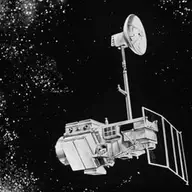
Landsat 5
2,572 tracked publications and 73,755 citations from 1985–2026. Launched 1984. Life-cycle cost: $1.4B in 2025 dollars. Active Mission Window April 1, 1984 to July 1, 2015: 818 publications, 29 top-10% credit.
Orbiter · h-index 115 · 134 papers with 100+ citations · prime mission ended 1987
Lifetime
Key measures
| Active Mission Window · papers April 1, 1984 to July 1, 2015 | |
|---|---|
| Tracked publications | 818 |
| Citations | 4,520 |
| Mean citations per publication | 5.5 |
| Median citations per publication | 3 |
| Uncited publications | 181 (22%) |
| Top-10% credit | 29 |
| Top-1% credit | 2 |
| Lifetime indices · every tracked publication to date, in any scope | |
|---|---|
| h-index | 115 |
| g-index | 198 |
| m-index, as of October 4, 2026 | 2.7 |
| tori | 620 |
| riq | 592 |
Tracked publications
An assessment of the effectiveness of a random forest classifier for land-cover classification
1,792
Land surface temperature retrieval from LANDSAT TM 5
1,516
Automated Water Extraction Index: A new technique for surface water mapping using Landsat imagery
1,441
Preliminary analysis of the performance of the Landsat 8/OLI land surface reflectance product
1,255
-
1,098
Widespread global increase in intense lake phytoplankton blooms since the 1980s
1,048
Remote sensing of aerosol properties over oceans using the MODIS/EOS spectral radiances
677
Revised Landsat-5 TM Radiometric Calibration Procedures and Postcalibration Dynamic Ranges
610
The global Landsat archive: Status, consolidation, and direction
577
The Global Mangrove Watch—A New 2010 Global Baseline of Mangrove Extent
489
Google Earth Engine Open-Source Code for Land Surface Temperature Estimation from the Landsat Series
457
-
450
-
450
Water Feature Extraction and Change Detection Using Multitemporal Landsat Imagery
439
-
418
Landsat continuity: Issues and opportunities for land cover monitoring
407
-
401
Radiometric rectification: Toward a common radiometric response among multidate, multisensor images
391
A visible band index for remote sensing leaf chlorophyll content at the canopy scale
349
-
344
How we found these papers
We searched NASA’s Astrophysics Data System (ADS) for peer-reviewed articles naming Landsat 5 in the title, abstract or keywords; standard filters drop articles that are not peer-reviewed and magazine pieces. SciX is ADS’s current interface.
((=abs:"Landsat-5" OR =abs:"Landsat 4-5" OR =abs:"Landsats 5" OR =abs:"Landsats 4 5" OR =abs:"Landsat TM5" OR =abs:"Landsat TM 5" OR =abs:"Thematic Mapper 5" OR =abs:"Thematic Mapper TM 5" OR =abs:"Landsat satellites 5" OR =abs:"Landsat satellite 5" OR =abs:"Landsat missions 5" OR =abs:"Landsat series 5" OR =abs:"Landsat 2 5" OR =abs:"Landsat 7 5" OR =abs:"Landsat 8 5" OR =abs:"Landsat 1 5" OR =abs:"Landsat 4 7" OR =abs:"Landsat 4 8" OR =abs:"Landsats 4 8" OR =abs:"Landsat 4 9")) AND property:refereed AND doctype:article AND pubdate:[1984-04 TO 2040-01] AND NOT bibstem:("A&R" OR "AIASJ" OR "AeAm" OR "AirSp" OR "AsNow" OR "AsUAI" OR "AvWST" OR "C&E" OR "C&T" OR "CAPJ" OR "E&S" OR "ENews" OR "IrAJ" OR "JCos" OR "JRASC" OR "LAstr" OR "MNSSA" OR "Met" OR "NewSc" OR "Orion" OR "PhT" OR "PhTea" OR "PhuZ" OR "PhyOJ" OR "PhyW" OR "PlR" OR "SciAm" OR "SpFl" OR "ZemVs")
Removed after review
- Landsat-7 Enhanced Thematic Mapper Plus Radiometric Calibration Pre-launch calibration plan for Landsat 7's ETM+; Landsat 5 appears as design heritage.
- Mapping and estimating forest area and aboveground biomass in miombo woodlands in Tanzania using data from airborne laser scanning, TanDEM-X, RapidEye, and global forest maps: A comparison of estimated precision A numbered list "(4) Landsat and (5)" matches; does not name Landsat 5.
- Monthly flooded area classification using low resolution SAR imagery in the Sudd wetland from 2007 to 2011 A numbered list "Landsat, and (5)" matches; does not name Landsat 5.
- Multiple trajectories of land-cover change: influence of disturbance severity over four decades after the eruption of Mount St. Helens The text "Landsat) at 5-year intervals" matches; does not name Landsat 5.
- A video system capable of simulating Landsat TM 5, 4, 3 imagery "TM 5, 4, 3" refers to Thematic Mapper bands; does not name Landsat 5.
- Spectral reflectance measurements in the genus Sphagnum "Thematic Mapper 5/4" refers to a band ratio; does not name Landsat 5.
- Impacts of urbanization on soil organic carbon stocks in the northeast coastal agricultural areas of China "Landsat TM5" refers to Thematic Mapper band 5; does not name Landsat 5.
- Gap-filling of land surface temperature in arid regions by combining Landsat 8 and 9 imageries The text "Landsat 8 and 5.4 °C" matches; does not name Landsat 5.